Saona Island Coastal Flood Risk: Storm Surge, Coastal Inundation and Resilient Infrastructure
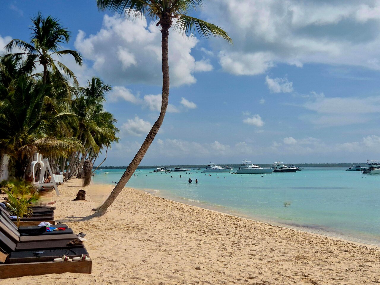
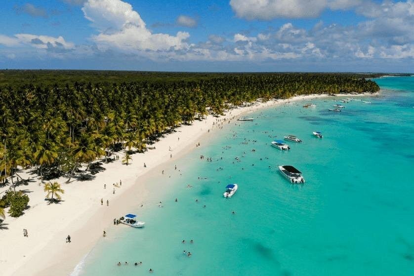
Saona Island, located off the southeastern coast of the Dominican Republic, is part of a coastal environment where the sea, shoreline and low-lying land interact. Understanding how coastal flooding can occur is important for long-term environmental planning, infrastructure protection and responsible coastal development.
Coastal flooding is not caused by one factor alone. During severe weather, storm-driven water levels can combine with astronomical tides, wave effects and rainfall. These processes may cause seawater to move beyond its usual shoreline and cover normally dry land.
For Saona Island, a reliable assessment requires local elevation surveys, coastal observations, bathymetric information and suitable hydrodynamic modelling. This article explains the engineering principles behind coastal flood risk assessment and the methods that can help planners evaluate potential hazards without assuming that a particular flood level or inundation zone has already been measured locally.
1. What Is Coastal Flood Risk?
Coastal flooding occurs when seawater or a mixture of seawater and rainfall runoff covers land that is normally dry. It can happen during tropical storms, hurricanes, unusually high tides and other extreme coastal water-level events.
Flood risk is broader than simply identifying how high the water may rise. It considers three connected elements:
- Hazard: The probability and physical characteristics of a flood event.
- Exposure: The people, buildings, roads, utilities, habitats and other assets located in potentially affected areas.
- Vulnerability: How easily those exposed elements may be damaged or disrupted.
A coastal location can experience a significant physical hazard but have different overall consequences depending on its population, infrastructure, land use and natural environment.
Risk assessment therefore combines physical modelling with information about what may be affected.
2. Understanding Storm Surge
Storm surge is an abnormal rise in coastal water level generated by a storm, above the predicted astronomical tide.
Strong winds can push surface water toward the coast. Lower atmospheric pressure can also contribute to a rise in water level. The shape of the coastline, offshore water depth and the direction and movement of a storm influence how the water accumulates.
Important factors include:
- Wind speed: Stronger storm winds can produce greater water movement toward the coast.
- Storm size: A large wind field can influence a wider coastal area.
- Storm movement: Forward speed affects how long winds act on a particular section of coast.
- Storm direction: The angle at which a storm approaches can change the amount of water pushed toward shore.
- Coastal geometry: Bays, headlands, islands and enclosed coastal areas can influence water movement.
- Seabed slope: Offshore bathymetry affects how storm-driven water responds near the coast.
The National Hurricane Center explains that storm surge is sensitive to storm intensity, forward speed, size, approach angle and coastal characteristics. These factors make local assessment essential.
3. Storm Surge, Storm Tide and Total Water Level
These terms are related but do not mean exactly the same thing.
Storm surge is the storm-driven rise above the predicted astronomical tide.
Astronomical tide is the regular rise and fall of sea level, mainly associated with the gravitational effects of the Moon and Sun.
Storm tide is the water level resulting from the combination of storm surge and astronomical tide.
Wave setup and wave run-up can raise water levels further near the shoreline. Wave setup is the increase in the average water level in the nearshore zone caused by breaking waves. Wave run-up describes the movement of individual waves up a beach or coastal slope.
Heavy rainfall and drainage conditions can also contribute to flooding, particularly when rainfall runoff occurs at the same time as elevated coastal water levels.
A simplified conceptual relationship is:
Total coastal water level = tide + storm surge + wave setup + other relevant water-level contributions.
This is a conceptual relationship rather than a universal calculation formula. In detailed studies, engineers must account for interactions between the processes and avoid double-counting components already represented in a numerical model.
4. Why Coastal Topography Matters
Topography describes the shape and elevation of the land. It is one of the most important inputs in coastal inundation modelling.
A low-lying coastal area may be more easily reached by elevated water than a nearby area with higher ground. However, elevation alone does not determine the full flood pattern.
Other important characteristics include:
- Ground slope and surface elevation.
- Natural depressions and drainage pathways.
- Dunes, vegetation and other natural barriers.
- Roads, embankments and constructed barriers.
- Channels connecting the sea with inland areas.
- Buildings and other structures that change water movement.
For Saona Island, a detailed digital elevation model would help researchers understand how the land surface could influence potential flood pathways. The model should be based on suitable local measurements rather than relying only on coarse regional elevation data.
5. The Importance of Bathymetry
Bathymetry is the measurement and mapping of underwater depth and seabed shape.
It is important because storm-driven water does not interact with the coastline independently of the offshore seabed. Water depth and seabed geometry influence wave transformation, currents and the movement of storm surge.
A coastal flood study may require:
- Offshore depth measurements.
- Nearshore bathymetric surveys.
- Shoreline and beach profiles.
- Intertidal elevation measurements.
- Accurate land elevation data.
Combining land topography and marine bathymetry creates a connected representation of the coastal system. This is particularly useful for numerical models that simulate water movement from offshore areas onto land.
6. How Engineers Map Coastal Inundation
Coastal inundation mapping identifies areas that could be covered by water under specified conditions.
A typical engineering workflow includes several stages.
Step 1: Collect Geographic Data
Researchers gather shoreline information, land elevation, bathymetry, land cover, drainage features and available coastal water-level observations.
Step 2: Establish Water-Level Scenarios
Different scenarios may represent ordinary high water, moderate storm conditions or more severe hypothetical events.
Each scenario should clearly state its assumptions, reference elevation and time conditions.
Step 3: Build a Numerical Model
Hydrodynamic models simulate water movement using mathematical descriptions of fluid motion. Depending on the study, models may represent tides, wind forcing, atmospheric pressure, storm surge, waves and inland drainage.
Step 4: Simulate Flood Extent and Depth
The model estimates where water may move, how deep it could become and how conditions may change over time.
Step 5: Validate the Results
Model outputs should be compared with available water-level records, historical flood observations, surveyed high-water marks or other reliable measurements.
Step 6: Prepare Risk Maps
The final maps can show potential inundation extent, estimated water depth, flow pathways and exposed assets.
A flood map is only as reliable as its input data, assumptions, resolution and validation. Screening maps should not be treated as precise property-level predictions.
7. Measuring Flood Exposure Around Coastal Communities
Flood exposure assessment identifies the assets that may be affected by coastal inundation.
For a coastal island study, the assessment could examine:
- Residential and visitor accommodation.
- Roads, paths and landing areas.
- Electricity and communication equipment.
- Freshwater storage and distribution.
- Wastewater and sanitation systems.
- Emergency access routes.
- Coastal habitats and protected natural areas.
Researchers can combine geographic information systems (GIS) with field surveys to compare the location of these assets against modelled flood zones.
The purpose is not simply to count buildings. It is to understand which services may be disrupted and whether alternative routes or facilities are available.
For example, a road that provides the only access to an important facility may deserve special attention even if the structure itself is not directly exposed to the highest predicted water depth.
8. Vulnerability of Coastal Infrastructure
Coastal infrastructure can be affected by more than direct water contact.
Potential impacts include:
- Floodwater entering buildings.
- Damage to electrical and communication equipment.
- Reduced access to roads and pathways.
- Contamination of freshwater supplies.
- Failure of drainage systems.
- Scouring around foundations.
- Damage to coastal protection structures.
- Disruption of tourism and local services.
Saltwater can also create longer-term maintenance challenges for exposed materials and equipment.
Engineers should evaluate both the immediate effects of inundation and the possibility of repeated exposure. A structure that survives one flood event may still experience progressive deterioration if it is repeatedly exposed to saltwater, moisture and debris.
9. Coastal Flood Risk Reduction Strategies
There is no single solution suitable for every coastal location. Effective risk reduction usually combines land-use planning, structural measures, natural features and preparedness.
Elevating Important Facilities
Where technically and environmentally appropriate, critical equipment and essential services can be placed above an assessed design flood level.
Electrical systems, pumps, communication equipment and control panels may require particular attention.
Improving Drainage
Drainage systems can help manage rainfall runoff. However, coastal drainage outlets may become less effective when sea levels are elevated.
Engineers should consider backflow, outlet submergence, storage capacity and the possibility of simultaneous rainfall and coastal flooding.
Designing Flood-Resistant Buildings
Building design can consider flood-resistant materials, protected service connections, elevated floors and suitable foundation systems.
The appropriate design depends on local soil conditions, expected water depth, flow velocity, debris and applicable engineering requirements.
Using Natural and Nature-Based Features
Vegetated coastal areas, wetlands, mangroves where naturally present, dunes and other suitable natural features can contribute to coastal protection.
Their performance depends on local ecology, width, condition, water depth and storm characteristics. Natural features should not be treated as guaranteed barriers against extreme flooding.
Planning Safer Access and Evacuation
Flood risk planning should consider safe routes, warning communication, access to essential services and arrangements for visitors who may not know the local environment.
10. The Role of GIS and Remote Sensing
Geographic information systems help engineers combine different types of spatial information.
A coastal flood assessment may use:
- Satellite imagery for shoreline and land-cover interpretation.
- Digital elevation models for ground height.
- Bathymetric datasets for underwater terrain.
- GPS or GNSS surveys for field positioning.
- Aerial photographs for site inspection.
- GIS layers for infrastructure and environmental exposure.
Remote sensing can cover large areas efficiently, but satellite-derived elevation products may not provide enough detail for every engineering application.
Field verification is essential where small changes in ground elevation, narrow drainage channels or constructed barriers could affect flood pathways.
11. Monitoring Coastal Water Levels
Long-term monitoring can improve understanding of coastal water-level variation.
A monitoring programme may include:
Tide gauges: Record changes in water level over time.
Pressure sensors: Measure pressure changes that can be converted into water-level estimates after appropriate corrections.
Weather stations: Record wind, atmospheric pressure and rainfall.
GNSS surveys: Help establish accurate land elevations and monitoring locations.
Field observations: Record flood marks, debris lines, damaged infrastructure and other evidence after an event.
All measurements should use clearly defined horizontal and vertical reference systems. Mixing elevation data that use different vertical datums can produce misleading flood-depth calculations.
12. A Possible Coastal Flood Assessment Framework for Saona Island
A future technical assessment of Saona Island could follow a structured process:
- Define the study boundary and identify important coastal zones.
- Collect suitable topographic and bathymetric information.
- Review available historical weather and water-level observations.
- Survey relevant drainage pathways and coastal structures.
- Develop several clearly defined flood scenarios.
- Run suitable hydrodynamic and inundation models.
- Compare model outputs with available observations.
- Map exposed infrastructure, visitor facilities and natural resources.
- Evaluate potential impacts and practical adaptation options.
- Prepare maps and recommendations with uncertainty clearly explained.
This is a proposed research framework, not a report of a completed flood survey. No specific flood depth, storm-surge height or high-risk zone should be attributed to Saona Island without verified local data.
13. Why Flood Risk Assessment Matters for Sustainable Tourism
Coastal destinations depend on functioning transport, safe visitor facilities, reliable services and healthy natural environments.
A well-designed flood risk assessment can help tourism planners understand where development may be unsuitable, which facilities need additional protection and how emergency access should be organized.
It can also support better decisions about the placement of utilities, maintenance of drainage systems and protection of environmentally sensitive areas.
For visitors, the practical lesson is to follow local weather warnings, obey instructions from authorities and tour operators, and avoid exposed coastal areas when dangerous conditions are reported.
Frequently Asked Questions
1. What is coastal flooding?
Coastal flooding occurs when seawater covers land that is normally dry. It may result from storm surge, high tides, wave effects or a combination of coastal and rainfall-related processes.
2. Is storm surge the same as a high tide?
No. A high tide is part of the regular astronomical tidal cycle. Storm surge is an additional rise in water level caused by a storm. Their combination is commonly called storm tide.
3. Why is bathymetry important in flood modelling?
Bathymetry describes underwater depth and seabed shape. It helps engineers understand how offshore water movement and waves interact with the coastline.
4. Can GIS predict coastal flooding?
GIS can combine elevation, bathymetry, land cover and infrastructure information to prepare flood exposure maps. More detailed predictions generally require suitable hydrodynamic modelling and reliable input data.
5. Does Saona Island have a confirmed coastal flood-risk map?
This article does not establish that a verified, detailed flood-risk map exists for Saona Island. A reliable local assessment would require suitable geographic data, field verification and validated modelling.
6. How can coastal communities reduce flood risk?
Potential measures include better land-use planning, improved drainage, flood-resistant construction, protection of suitable natural coastal features, monitoring and emergency preparedness.
7. What is the difference between flood hazard and flood risk?
Flood hazard describes the physical flooding conditions and their likelihood. Flood risk also considers exposure and vulnerability, including the possible consequences for people, infrastructure and ecosystems.
Conclusion
Coastal flood risk assessment is an important part of responsible coastal engineering and long-term planning. Storm surge, tides, wave effects, rainfall, topography and underwater seabed conditions can interact to influence coastal inundation.
For Saona Island, a reliable assessment should begin with accurate elevation and bathymetric information, local observations and clearly defined modelling scenarios. Engineers can then identify potential exposure, evaluate infrastructure vulnerability and recommend suitable risk-reduction measures.
The goal is not to assume that every coastal area will flood in the same way. It is to understand local conditions, communicate uncertainty and support decisions that protect people, infrastructure and the natural coastal environment.
Local explorer & expert guide in Silven International.