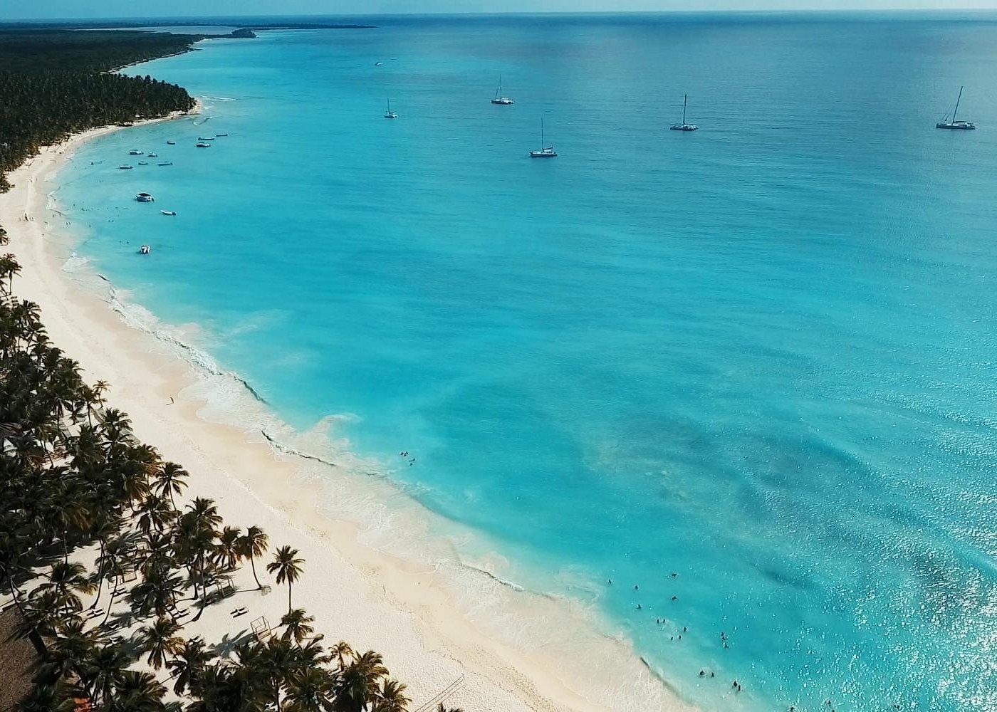
Saona Island Tsunami Hazard Assessment: Wave Inundation, Evacuation Mapping and Coastal Preparedness
Saona Island is a Caribbean island off the southeastern coast of the Dominican Republic. Like other coastal and island environments, its long-term safety planning benefits from understanding the natural processes that can affect the shoreline.
One hazard that requires specialized scientific assessment is a tsunami. A tsunami is a series of long-period ocean waves generated by the displacement of a large volume of water. Underwater earthquakes are a major cause, although submarine landslides, volcanic activity and other disturbances can also generate tsunamis.
Tsunami impacts depend on the source of the disturbance, the direction of wave propagation, offshore bathymetry and the shape and elevation of the coastline. A wave that travels across deep ocean water can behave very differently when it approaches shallow coastal areas.
For Saona Island, a reliable assessment would require regional tsunami-source information, detailed bathymetric and topographic data, numerical modelling and local preparedness planning. This article explains how such an assessment could be carried out. It does not establish that a particular tsunami threat, inundation boundary or evacuation zone has been confirmed for the island.
1. What Is a Tsunami?
A tsunami is a sequence of ocean waves produced by a sudden displacement of water.
Unlike ordinary wind-generated surface waves, tsunamis usually involve movement through a substantial portion of the water column. Their wavelengths can be extremely long, and their behaviour is strongly influenced by water depth.
Common tsunami-generating processes include:
- Large undersea earthquakes that vertically displace the seabed.
- Submarine landslides that move large volumes of sediment.
- Volcanic eruptions or collapses that displace water.
- Certain coastal or underwater slope failures.
- Rare impact events involving large objects entering the ocean.
Not every earthquake produces a tsunami. The likelihood depends on factors such as earthquake location, magnitude, depth, fault mechanism and the amount of vertical seabed displacement.
A tsunami should also not be confused with a storm surge. Storm surge is mainly associated with wind and atmospheric pressure during storms, whereas a tsunami is generated by a sudden displacement of water.
2. Why Tsunami Assessment Matters for Island Environments
Island coastlines can have different exposure characteristics depending on their orientation, bathymetry, elevation and distance from potential tsunami sources.
An island may have one coastline facing a different direction from another. Consequently, the same offshore tsunami scenario may produce different coastal responses around the island.
A scientific assessment can help investigate:
- Which potential tsunami sources could affect the surrounding region.
- How long waves may take to travel toward the coast.
- Which shoreline sections may experience greater water-level changes.
- Where inland inundation could occur under defined scenarios.
- Which roads, facilities and visitor areas may be exposed.
- What evacuation routes and communication arrangements may be required.
The purpose is to provide evidence for planning rather than assume that every coastal location has the same level of hazard.
3. Potential Sources of Caribbean Tsunamis
Tsunami assessment begins by identifying possible sources capable of generating waves that could reach a study coastline.
The wider Caribbean region has complex tectonic boundaries and geological structures. Relevant scientific investigations may consider several types of potential sources.
Subduction-Zone Earthquakes
At subduction zones, one tectonic plate moves beneath another. Large earthquakes along these boundaries can cause vertical seabed displacement.
The resulting movement can displace seawater and generate tsunami waves.
Strike-Slip and Other Fault Systems
Some fault systems involve predominantly horizontal movement. These events may have a different tsunami-generating potential from earthquakes that produce substantial vertical seabed displacement.
However, local seabed geometry, secondary movement and associated landslides can complicate the assessment.
Submarine Landslides
Underwater slope failures can rapidly move sediment and rock. If the displaced material moves enough water, it may generate tsunami-like waves.
The potential impact depends on the size, speed, depth and location of the landslide.
Volcanic Sources
Volcanic activity can generate water displacement through explosions, flank collapse or related underwater disturbances.
These mechanisms require separate source characterization and modelling assumptions.
A regional assessment should evaluate plausible sources using reliable geological, seismic and historical information rather than treating all earthquakes or volcanic events as tsunami-generating.
4. How Tsunami Waves Travel Across the Ocean
Tsunami propagation is controlled by water depth, wavelength and the geometry of the ocean basin.
For long waves in shallow-water theory, the approximate wave speed is:
c = √(g × h)
Where:
- c = wave speed.
- g = acceleration due to gravity.
- h = water depth.
This relationship shows that tsunami propagation speed depends strongly on water depth.
In deep water, a tsunami can travel at high speed while its surface height may remain relatively small. As it enters shallower water, its speed decreases and its wavelength becomes shorter.
Depending on the energy, coastal geometry and seabed conditions, the wave may increase in height as it approaches land.
The actual behaviour is more complex than the simplified equation. Numerical models are used to account for changes in bathymetry, wave reflection, refraction, friction and nonlinear effects.
5. What Happens When a Tsunami Reaches the Coast?
When a tsunami enters shallow coastal water, several processes influence the resulting inundation.
Shoaling
Shoaling occurs when wave characteristics change as the wave moves into shallower water. Wave speed and wavelength decrease, and wave height may increase depending on the conditions.
Refraction
Different parts of a wave can travel at different speeds because water depth varies. This can change the direction of wave propagation.
Reflection
Waves may reflect from coastlines, islands and other boundaries. Reflected energy can interact with incoming waves and influence local water-level patterns.
Inundation
Inundation occurs when tsunami water moves inland beyond the normal shoreline.
The distance reached depends on water level, flow momentum, ground elevation, surface roughness and local topography.
Strong Currents
Tsunamis can produce dangerous currents in coastal waters, harbours, channels and around structures. Even where inland flooding is limited, strong water movement can create serious hazards.
These processes explain why a tsunami assessment should examine more than maximum wave height alone.
6. What Is a Tsunami Hazard Assessment?
A tsunami hazard assessment is a scientific process used to estimate how potential tsunami events may affect a coastline.
It usually combines historical information, source analysis, numerical simulation and geographic data.
A typical assessment investigates:
- Potential tsunami-generating sources.
- Earthquake or other source characteristics.
- Wave propagation across the ocean.
- Coastal water-level changes.
- Maximum inundation extent.
- Flow depth and current speed.
- Wave arrival time.
- Uncertainty associated with the scenarios and data.
The assessment may use deterministic scenarios, probabilistic methods or a combination of both.
A deterministic study examines specified events or scenario sets. A probabilistic study evaluates a wider range of possible sources and their associated likelihoods, where suitable data and methods are available.
The U.S. Geological Survey's 2026 review of tsunami hazard and risk frameworks describes the use of modelling, uncertainty analysis, vulnerability assessment and probabilistic approaches in modern tsunami research.
7. The Importance of Bathymetry and Topography
Accurate geographic data are essential for reliable tsunami inundation modelling.
Two major datasets are required:
Bathymetry describes underwater depth and seabed shape.
Topography describes the elevation and shape of the land surface.
These datasets should connect across the shoreline so that models can represent wave movement from offshore waters onto land.
Important data requirements include:
- Offshore seabed depth.
- Nearshore bathymetric measurements.
- Beach and shoreline elevation.
- Inland ground elevation.
- Coastal channels and depressions.
- Natural barriers and constructed structures.
- Suitable vertical reference information.
Low-resolution regional data may be useful for preliminary screening, but detailed inundation mapping requires sufficiently accurate local elevation information.
For Saona Island, the required data would need to be checked and, where necessary, collected through hydrographic and land-survey work.
8. Numerical Modelling of Tsunami Inundation
Numerical modelling is one of the main tools used to investigate how tsunami waves may affect a coastline.
A model uses mathematical equations to represent the movement of water under specified conditions.
A typical modelling process includes the following stages.
Stage 1: Define the Source Scenario
Researchers specify the location, size and physical characteristics of a possible tsunami-generating event.
For an earthquake scenario, this may include magnitude, fault geometry, depth and seabed displacement.
Stage 2: Model Wave Generation
The model estimates the initial disturbance in the water surface associated with the source.
Stage 3: Simulate Ocean Propagation
The tsunami is simulated as it travels across the ocean basin toward the study area.
Stage 4: Refine the Coastal Grid
Higher-resolution bathymetric and topographic grids may be used near the coast to represent local water movement more accurately.
Stage 5: Calculate Inundation
The model estimates how far water may travel inland, along with flow depth, current speed and water-level variation.
Stage 6: Compare Scenarios
Multiple possible sources and assumptions may be examined to understand the range of potential impacts.
Stage 7: Validate and Review
Where observations from historical events or other reliable sources exist, they can help assess model performance. Uncertainty and data limitations should be documented.
NOAA's tsunami modelling programme describes the use of high-resolution bathymetric and topographic grids for inundation studies and the production of outputs such as maximum wave height, current speed, inundation extent and arrival-time information.
9. Understanding Tsunami Inundation Maps
A tsunami inundation map shows areas that could be covered by water under defined scenarios.
These maps can be used by planners, emergency managers and communities to understand potential exposure.
Common map outputs include:
Inundation extent: The estimated boundary of land reached by tsunami water.
Flow depth: The estimated depth of water at a location.
Maximum wave height: A measure of the highest modelled water elevation, defined relative to an appropriate reference level.
Current velocity: The speed and direction of water movement.
Arrival time: The estimated time between tsunami generation and the arrival of relevant waves at selected locations.
Uncertainty information: An explanation of the assumptions, data limitations and confidence associated with the results.
An inundation map is scenario-based. It should not be interpreted as a guarantee that every future tsunami will follow exactly the same boundary.
10. From Inundation Maps to Evacuation Maps
A tsunami inundation map and an evacuation map serve different purposes.
An inundation map describes the modelled physical hazard. An evacuation map translates hazard information into practical guidance about where people should go.
The development of an evacuation map should consider:
- Safe areas outside the designated hazard zone.
- Walking routes and alternative routes.
- Ground elevation and accessibility.
- Bridges, narrow passages and other bottlenecks.
- The location of visitor facilities.
- The needs of children, older adults and people with disabilities.
- Communication and warning arrangements.
- The time required to reach safer locations.
UNESCO's Tsunami Evacuation Maps, Plans and Procedures programme emphasizes the connection between scientific inundation mapping and community-developed evacuation plans.
For an island environment, access to safe destinations and the availability of routes are particularly important planning questions.
A map should be reviewed with local authorities and people familiar with the area before being treated as an operational evacuation guide.
11. Tsunami Warning and Early Information
Tsunami warning systems use several types of information to assess whether a tsunami has been generated and whether it may affect a coastline.
These may include:
- Seismic monitoring.
- Coastal sea-level stations.
- Deep-ocean pressure sensors.
- Numerical tsunami models.
- Communication between warning centres and emergency authorities.
NOAA's Deep-ocean Assessment and Reporting of Tsunamis (DART) system uses ocean-bottom pressure measurements and reporting buoys to detect and transmit tsunami-related sea-level information in the open ocean.
Regional warning products and official instructions are important for public safety. Visitors should follow the competent national and local authorities rather than rely on unofficial estimates or self-generated predictions.
A warning system is only one part of preparedness. Communities also need clear communication, evacuation arrangements and regular awareness activities.
12. Tsunami Preparedness for Coastal Visitors
Tourists may be unfamiliar with local geography, warning procedures and safe routes. Preparedness information should therefore be easy to understand and accessible.
Useful planning measures include:
- Clearly displayed emergency instructions.
- Information about official warning channels.
- Identified evacuation routes where approved.
- Staff awareness and emergency procedures at visitor facilities.
- Communication arrangements for visitors.
- Periodic practice exercises.
- Coordination with relevant local authorities.
Natural warning signs can also be important. A strong or prolonged earthquake near the coast, an unusual rapid withdrawal or rise of the sea, or a loud ocean roar may indicate a possible tsunami.
People who observe natural warning signs should move away from the shore and toward safer ground immediately, without waiting for an official message. They should follow official guidance and avoid returning until authorities issue an all-clear.
13. A Possible Tsunami Research Framework for Saona Island
A future tsunami assessment for Saona Island could follow a structured scientific and planning process.
Step 1: Review regional tsunami sources. Examine credible earthquake, landslide and volcanic source information relevant to the wider Caribbean.
Step 2: Review historical records. Compile documented tsunami observations and regional scientific publications, while distinguishing confirmed events from uncertain accounts.
Step 3: Collect coastal geographic data. Obtain suitable bathymetric and topographic information with compatible reference systems.
Step 4: Select modelling scenarios. Define credible source scenarios and document the assumptions behind each one.
Step 5: Run numerical simulations. Estimate wave propagation and potential coastal inundation under the selected scenarios.
Step 6: Prepare hazard maps. Map potential inundation extent, flow depth, current speed and arrival-time information.
Step 7: Assess exposure. Identify visitor facilities, infrastructure, access routes and other assets that may be located in modelled hazard areas.
Step 8: Develop evacuation planning materials. Work with responsible authorities to identify practical routes, safe destinations and communication procedures.
Step 9: Conduct preparedness exercises. Test the clarity and practical usability of the plans.
Step 10: Review and update. Improve the assessment when better elevation data, new scientific information or changes in coastal development become available.
This is a proposed research framework, not evidence that a completed tsunami hazard assessment or evacuation map already exists for Saona Island.
14. Important Limitations and Uncertainty
Tsunami modelling involves uncertainty at several stages.
The exact characteristics of a future earthquake or other source may not be known in advance. Seabed displacement estimates can vary, and local bathymetric data may be incomplete.
Other uncertainties include:
- Numerical model assumptions.
- Grid resolution.
- Coastal friction and roughness.
- Representation of buildings and natural barriers.
- Tidal conditions at the time of an event.
- Changes in shoreline geometry.
- Historical record completeness.
A responsible assessment should present more than one plausible scenario where appropriate and clearly explain the limitations.
A single maximum inundation line should not be presented as a precise prediction of every future event.
Frequently Asked Questions
1. What causes a tsunami?
Tsunamis can be caused by large undersea earthquakes, submarine landslides, volcanic activity and other events that suddenly displace a large volume of water.
2. Is a tsunami the same as a storm surge?
No. Storm surge is primarily generated by storm winds and atmospheric pressure. A tsunami is generated by a sudden displacement of water, commonly associated with an underwater earthquake.
3. Can a tsunami travel across the Caribbean Sea?
Tsunami waves can propagate across ocean basins. Whether a particular source could affect a specific Caribbean coastline depends on the source characteristics, propagation path and local coastal conditions.
4. What information is needed to map tsunami inundation?
Important inputs include tsunami source scenarios, bathymetry, land elevation, coastal geometry and suitable numerical modelling. Historical observations can also support model validation.
5. What is the difference between a tsunami hazard map and an evacuation map?
A hazard map shows areas that may be inundated under specified scenarios. An evacuation map provides practical routes and safe destinations for people who need to move away from exposed areas.
6. Does a tsunami always arrive as one large breaking wave?
No. A tsunami is usually a series of waves. The first arrival may not be the largest, and dangerous currents or repeated inundation can continue after the initial arrival.
7. Does Saona Island have a confirmed tsunami evacuation map?
This article does not verify the existence of an approved, detailed local tsunami evacuation map for Saona Island. Such information should be confirmed through the responsible Dominican authorities.
8. What should visitors do if they notice natural tsunami warning signs?
Move away from the coast immediately toward safer ground or an appropriate designated safe area. Follow official emergency instructions and do not return until authorities issue an all-clear.
Conclusion
Tsunami hazard assessment combines geological source analysis, ocean-wave modelling, coastal geographic data and emergency planning. It helps scientists understand how potential tsunami events may travel across the ocean and interact with coastal landscapes.
For Saona Island, a reliable assessment would require regional source evaluation, high-quality bathymetric and topographic data, numerical inundation modelling and cooperation with responsible authorities. The results could then support practical evacuation planning and visitor preparedness.
The key is to distinguish scientific scenarios from confirmed local hazard information. Careful modelling, transparent uncertainty and community-based preparedness provide a stronger foundation for coastal safety than unsupported assumptions.
Local explorer & expert guide in Silven International.